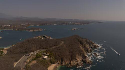
HUATULCO, Mexico – Beneath the waves of the Oaxacan coast, a sophisticated network of scientific instruments is currently working toward a profound and vital goal: predicting earthquakes and tsunamis before they strike. A groundbreaking international collaboration between Mexican and Japanese institutions is transforming the region into a natural laboratory to improve early warning systems in one of the world’s most seismically active zones.
The project represents a high-level scientific partnership between the National Autonomous University of Mexico (UNAM) and the leading universities of Kyoto and Tōhoku. Together, researchers have deployed seafloor monitoring equipment capable of recording tectonic deformations, pressure changes, and seismic activity in real time.
A Decade of Scientific Diplomacy
The initiative trace its roots back to 2016, following the devastating 2011 earthquake and tsunami in Japan. A delegation of Japanese seismologists visited the UNAM Institute of Geophysics to establish a collaborative framework. This cooperation was initially funded by the Science and Technology Research and Development Agency (SATREPS) and has since expanded to include researchers from El Salvador, who are interested in similar tectonic phenomena in the region.
The project is particularly significant because it moves beyond land-based sensors. By placing instruments directly on the seabed, scientists can observe the subduction zone—where the Cocos Plate slides beneath the North American Plate—to witness the origin points of major earthquakes.
Tracking “Slow Earthquakes”
One of the primary focuses of the project is the study of “slow earthquakes.” Unlike traditional seismic events, these are less perceptible phenomena that release energy gradually. While they produce low-amplitude signals known as tectonic tremors, they are crucial for understanding tectonic dynamics.
“We are interested in knowing if these occur near the oceanic trench, because they can reveal processes that lead to the rupture of a major earthquake,” explains Dr. Víctor Manuel Cruz Atienza, a lead researcher at the UNAM Institute of Geophysics.
The Human Factor: Saving Lives
The ultimate objective of this research is public safety. The coastline of southern Mexico is part of the “Ring of Fire,” a seismic belt where nearly 90% of the world’s seismic activity occurs. A massive earthquake in this region could generate devastating tsunamis, similar to the 1787 event off the coast of Oaxaca, which was estimated at a magnitude of 8.6.
In such scenarios, every minute is critical for evacuating coastal populations. Dr. Cruz emphasizes that while authorities like Civil Protection and Cenapred work tirelessly on public awareness, it is essential for citizens to identify high-ground safety zones. “I always tell people going to Puerto Escondido to identify a hill or ensure their hotel is not at sea level so they can evacuate quickly,” Cruz notes.
Challenges and Progress
Despite the project’s successes, the scientific community faces hurdles in funding. A more ambitious proposal for a 25-instrument underwater network, which would have required approximately 230 million pesos, was recently declined by civil protection authorities. Consequently, the current focus remains on a smaller, targeted network designed to understand the specific role of slow earthquakes.
Nevertheless, the deployment marks a major milestone in Mexico’s integration into international seismic research networks. Beneath the Pacific waves, these sensors operate in silence, gathering data with the hope of providing the crucial minutes of warning needed to face the unpredictable forces of nature.