The Government of Mexico signed the phytosanitary protocol for exporting sorghum with the People’s Republic of China.
With this signing of the phytosanitary export protocol, sorghum is added to pork and beef, tequila, strawberries, white corn, leaf tobacco, milk and dairy products, avocado, blueberries, grapes and bananas as the products that comply with all the phytosanitary requirements to be exported to the Asian country from Mexico.
The protocol was signed through the Secretary of Agriculture and Rural Development, Eng. Víctor Manuel Villalobos Arámbula, and the Ambassador to Mexico of the People’s Republic of China, C. Zhu Qingqiao.
According to Secretary Villalobos, the projection after the signing of this agreement is that a volume between 50 thousand and 100 thousand tons of Sorghum will be exported to China, mainly through the States of Sinaloa and Tamaulipas, leading producers in Mexico of said product.

The Secretary of Economy, Javier Lizárraga Mercado, trusted that this signing of the sanitary export protocol for sorghum with the People’s Republic of China will take advantage of the great opportunity given the constant trade war between China and the United States on tariffs, which has caused a decrease in the sorghum trade between both countries, that is why, said the Minister of Economy that Sinaloa can take advantage of this area of opportunity thanks to the logistics platform that allows connecting the State with the Asian country, and Sinaloa also has an important area for production of sorghum, with the phytosanitary export protocol, state producers can attack the market niche and allocate more hectares to the production of this grain to supply a market as large and demanding as China.
Mexico is one of the main sorghum producers worldwide, however, the vast majority of its production remains for national consumption, even becoming an importer of said product to satisfy the demand of the local market. According to Trade Map, the main destination of sorghum exports is from the United States, as well as its main supplier, importing 220,376 tons of it in 2018 according to data provided by Trade Map.
At the national level, Mexico planted a total 1,364,795.14 hectares destined for the production of sorghum, having a production of 4,352,947.01 tons, with Tamaulipas leading the list of the largest producers in the country, escorted by Guanajuato and Sinaloa.
WHY SINALOA?
LOGISTICS INFRASTRUCTURE
Sinaloa is the geographical point closest to the Pacific Ocean of the immense market of the North American Midwest, and, with this, it facilitates the traffic of products to that area of the United States of America.
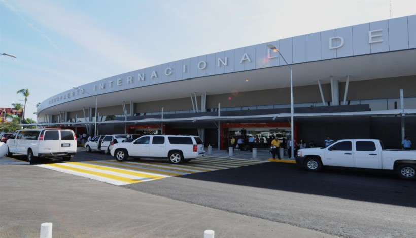
It has three international airports
1. The Culiacán International Airport is an airport that handles the national and international traffic of the city of Culiacán, Sinaloa, Mexico. This airport is part of Grupo Aeroportuario Centro Norte and is the airport with the highest number of passengers and operations in the state of Sinaloa. It has a capacity for 22 operations per hour. It is the 9th busiest airport in Mexico.
2. The Mazatlán International Airport is an airport that handles the national and international traffic of the city of Mazatlán, Sinaloa, Mexico. This airport is the second most important in Sinaloa, after the Federal International Airport of Culiacán . It is located in the southeast area of the city and is one of four airports in Mexico that has a Control Area Center (Mazatlán Center), the others being in the Mexico City International Airport, Monterrey International Airport and International Airport of Mérida. Centro Mazatlán controls air traffic over the northwestern part of the country.
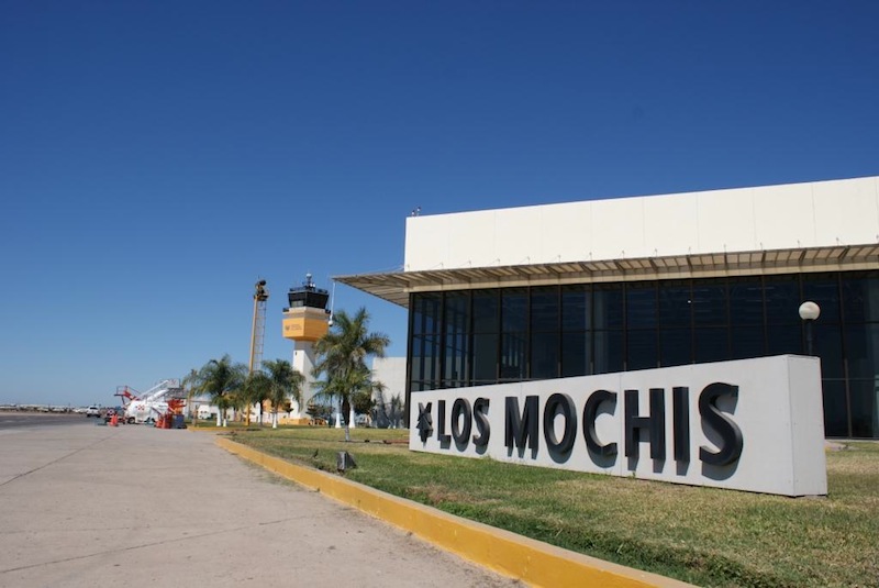
3. Los Mochis International Airport is an airport that handles national and international traffic in the city of Los Mochis, Sinaloa, Mexico. This airport is managed by Grupo Aeroportuario del Pacífico and is the third airport with the largest number of passengers and operations in the state of Sinaloa.


16,965 km of roads
The state of Sinaloa has one of the largest road networks in the country, it is in the 7th position, it has a total length of land roads of 16,965 km, distributed in 5 categories, which are:
- Four-lane highways 68%
- Two-lane highways 74%
- Coated roads 71%
- Dirt roads 10%
- Gaps 77%
Sinaloa has 793 km of 4-lane highways that places it number 7 in the country, and its 4,367 km of 2-lane highways places it number 16.
The federal highways that run through the state are: Federal Highway 15 , Federal Highway 15D , Federal Highway 24 , Federal Highway 40 and Federal Highway 40D
25.74 %
Two lane highways
4.68 %
Four lane highways
19.10 %
Dirt roads
Sinaloa: Two high-altitude ports with all services
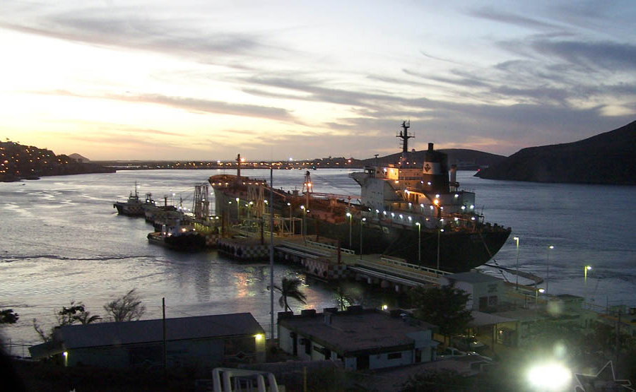
The state of Sinaloa has 2 maritime ports: the port of Mazatlán and the Port of Topolobampo.
1.Topolobampo is a high-altitude and coastal port with maritime, land and air connections. It communicates the regions of the Sea of Cortez with the West of Mexico. The port of Topolobampo links the region with other northern states of Mexico thanks to the Chihuahua-Pacific Railroad, whose passenger terminal is located in the city of Los Mochis. In the port is also the terminal for the ferry lines that connect the north of Sinaloa with La Paz and Los Cabos, in Baja California Sur. As a result of the development developed and the expansion of the southwest area of the port, interest in investing in new businesses has been encouraged, the number of service providers has grown and the installation of others such as Fertilizers (ISAOSA) and the new Line of California Maritime Transportation Ferries.
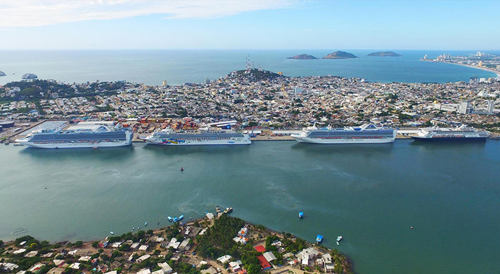
2.Mazatlán is today a tourist, commercial and fishing port, located a few kilometers south of the Tropic of Cancer, at the point of confluence of the Pacific Ocean and the Sea of Cortez, facing the southern tip of the La peninsula. Baja California with which it connects via ferry; being the most important connection port on the western coast of Mexico with Los Angeles, Panama and the Mediterranean. It is located on a small peninsula that projects into a natural bay, thus separating the fishing fleet and boat traffic from the beach line, which extends 26 km to the north.


Railroad network
The state of Sinaloa has one of the largest railroad networks in the country, it is in 8th place, with a total length of railways of 1,194.5 km, distributed in 3 categories, which are: trunk and branch lines, secondary and individuals.
Of the total number of railways (1,194.5 km), 75.79% are trunk and branch lines, 19.02% are secondary, and 5.19% are private. Most of the railway network currently serves for the transport of goods.
The state has the Chihuahua to the Pacific Railroad , it transports passengers, it is an important railway line in northwestern Mexico; it connects the cities of Chihuahua in the state of Chihuahua and Los Mochis, in the state of Sinaloa, on the Pacific Ocean coast. It travels 673 km, crossing the Copper Canyon, this railway is better known as ” El Chepe” , and it is a very important tourist attraction in Mexico.

Northern Economic Corridor
Sinaloa, Durango, Coahuila, Chihuahua, Nuevo León, Zacatecas, Tamaulipas and Nayarit are the states that make up the Northern Economic Corridor.
This highway is the connection with Texas through the Super Via Mazatlán – Matamoros, which connects Mazatlán with the East Coast of the US, crossing an area that produces 23.14% of the National GDP.
The Mazatlán-Durango Highway is part of the Northern Economic Corridor and brings the city of Durango from six hours to two and a half hours, and at the same time, allows a greater and faster flow of goods between Sinaloa and the Northeast of the Republic, as well as the United States.
Topolobampo – Ojinaga Highway, which connects the port of Topolobampo with the state of Texas, USA.
Source: citsinaloa.gob.mx, pmxportal.com


